Prudence Island Activation – US Islands-RI008S
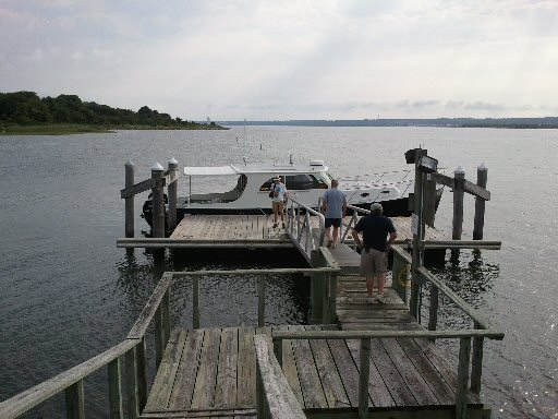
John and his team activated Prudence Island July 26, 2014. The trip over in Barbara E to the floating dock was smooth in beautiful wx.
Prudence is one of the Bay Islands in the Narragansett Bay National Estuarine Research Reserve. W1SYE set up shop on the porch of the DEM Natural History building, convenient shore power, but quiet bands.
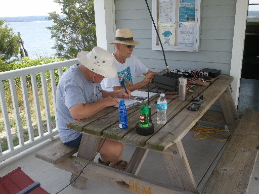
Ops: John K1JSM, Richard KC1ARQ, Gary, N8ZFH, and Jack W1QZ.
| Event Identification | Island Identification | ||
| Activation | Position | RSGB IOTA | US Islands |
| Prudence Island | 41° 36’21″N 71° 18’16″W | NA-031 | RI 008S |
Primary Coordinator: J. Mills, K1JSM
Coordinated with permission from: DEM and Narragansett Bay Research Reserve.
Radio Equipment:
- HF radio – Elecraft K2
- power supply – SEC1235, coax & wire antenna
- Honda 1000 generator (for back-up),
- VHF handheld – Icom 51
Operating notes:
- call sign = W1SYE stroke PRUDENCE ISLAND
- operating: SSB, 20 & 40 m
- Suggested frequencies: 14.260, 14.270-14.290, 14.320-14.340
- 7.180-7.200, 7.270-7.290
Alternative Transportation:
Ferry to Prudence: $32.70 plus $10 parking for car & driver
See: http://nbnerr.org/to_prudence.htm
Current ferry schedule available at www.prudenceferry.com
K1JSM will take his boat to the T-wharf for the day. All operators are welcome to ride along, departing New England Boatworks Slip #241 at 0830. It is only 2 miles to the wharf on Prudence Island. We’ll be returning between 1600-1700.